
100k team relay
6 am Saturday March 29, 2025
Get the Band back together!
Teams of Four
WHERE: THE PAVILLION, PIONEER PARK, BRIGHT
Distance: 100.1 km
Elevation: 4,930m+-
Cut off: 28 hours
Prize Presentations for Category Winners: 10:00 AM Sunday
Course Description
An epic course from the alpine township of Bright, to the Horn, the highest point of the Mount Buffalo National Park, and back. With 4922 metres of elevation gain over 100km, this is a challenge for your mind, body and your love of the mountains.
Starting at 6am at The Trailhead at the Pavillion, runners will only have 1.8km to warm up before the first climb up Emily's Spur (1.7km, 440m+) to the summit of Mystic. In 2025 the course now includes a new traverse from Mystic to Clearspot along the local favourite route of Water Reserve Track. This is an incredible ridge line with some sharp pinches mostly up but sometimes down!
The Race makes its way around to Clearspot Aid Station, with Stunning views of the course that awaits. Take a quick breather before the long undulating descent of Snake Ridge. This descent has some kickers in it so don't turn off the climbing legs yet, and enjoy the views!
Traverse the 3km of road across the Buckland Valley before starting the climb up Keatings Ridge, which is your entrance into the Mount Buffalo National Park. Descend the other side of this serene dirt road, down to Eurobin Creek Aid Station.
The Big Walk awaits, with 10km and 1000m+ of climbing. this climb will take you on a journey through the steep lower slopes, to the gently pitched single track in the middle, to the rocky sections around Mackays with exceptional views, to finally spitting you out at the Chalet.
From here you begin the 28km of the course on the Mount Buffalo Plateau where you traverse lands that home plants found nowhere else on earth. These trails are remote and beautiful. Settle into your rhythm at altitude and enjoy Lake Catani, Long Plain Track, the Cathedral and the Hump. Runners summit the Horn at over 1,723 metres to 360’ degree views of the National Park plateau and the Australian Alps.
Loop your way back to the Chalet past Mt Dunn, the reservoirs and the Monolith Track. Here you truly are on your way home with the big descent off the mountain down the Big Walk. Retrace your steps over Keatings Ridge and through the Buckland to the bottom of Dingo Ridge Climb.
Dingo Ridge is your final test, coming 88km into the race, it is the final climb but a big one, with 757m+ over 6.3km to Clearspot. Recoup at the Aid Station, then turn around for a little out and back to the high point of Eagle Peak before heading back along Water Reserve Track to the Top of Middle Track. Last year Middle Track was included as an early climb in the 100k, this year is the final descent. It is loose, rocky and technical. Every runner will be in full survival mode.
From the bottom there is 5km to go mostly downhill! Scoot down some sweet local single tracks in Bakers Gully until you hit the backstreets of Bright. Run through some streets with care before hitting the Morses Creek river trail and heading upstream along it towards the finish. Resist the urge to swim in the river's water (or do it!) because there is only 1km to go. Eventually the course turns right up a slight rise and the view of the Pavillion and the Event Village opens up.
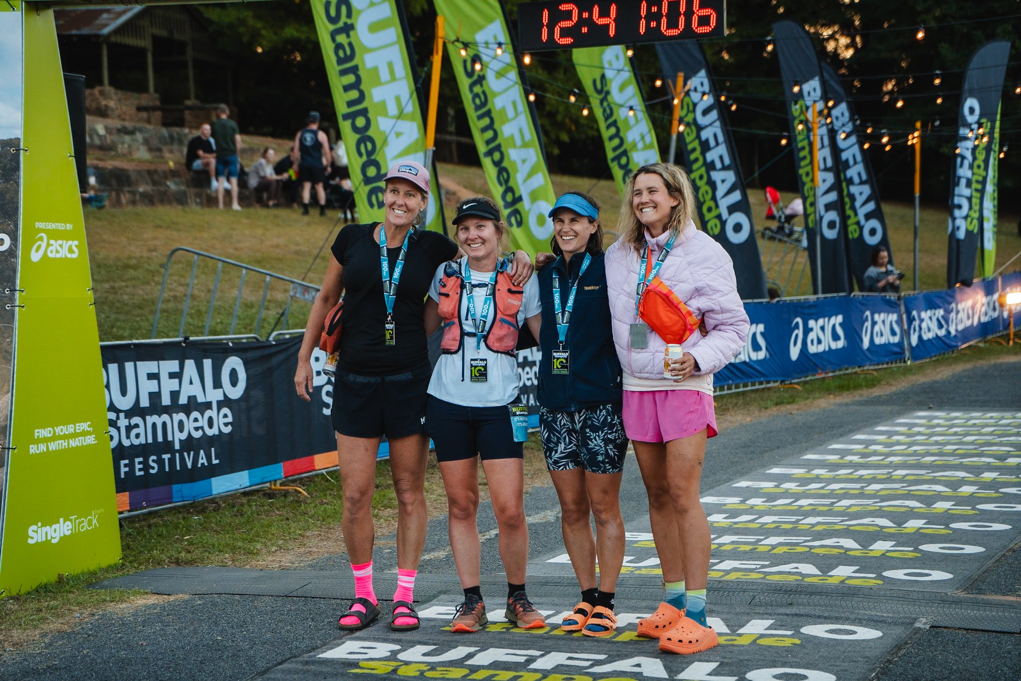
Join your Team as you all cross the finish line together and bask in your shared glory.
If one or more runner cannot complete their leg, we will be flexible in letting the other runners share the load in completing the full course.
The Course
AVENZA MAP
This maps allow you to locate yourself when on the course (or not on the course and trying to find your way back to it!). In other words, when you arrive in Bright and you are on the map area, you will see your exact location and the direction your phone is facing show up on your screen. This is invaluable to anyone running any of the races as you can always be sure you are on course or how to get back to it.
AVENZA Maps is an App you can download from your App Store. You will need to create a free account, you can search "Buffalo Stampede 100k 2025" in the AVENZA App "Store" and see the Map to download. Or you can click the link to the map of your race below. Just a quick tip that this is all easiest to do from your phone.
You will see that you can buy and download the race maps for free on AVENZA and once downloaded, they are always in the app and loaded. So when you are out on course, and you don't have reception, it doesn't matter, you can still see the entire map and where you are on it.
Try it out NOW, load your map(s), zoom in and out and familiarise yourself with the course. You will notice that having the AVENZA Map downloaded to your phone, or having the GPS route loaded to your watch, is part of the Mandatory Gear.
FAQs
-
This is the big one, the ultimate journey from Australia’s favourite mountain town to the peak of Mount Buffalo National Park (The Horn) and back.
It all starts in the dark early hours at 6am in Bright at the Event Village. Runners will need a headtorch for the first few kilometres as they embark on their journey. To Start the 100k takes in 800m of Pioneer Park's wide paved roads before hitting the river trails to Mystic Bike Park. After a short stint on the shuttle road, runners turn upwards and tackle the infamous climb of Emily's Spur. In a mile, the course climbs 440m along the exposed ridgeline, with epic views. Summiting Mystic and seeing the views from Mount Buffalo to Bright, it might not feel like it, but it means the journey has only just begun.
Here the course changes from previous years and we finally get to introduce the Water Reserve Track to the Buffalo Stampede. This trail is one of the most regularly used link ups in the area and is part of the famous Mystic - Clearspot Loop from Bright. It follows the high point through the natural bush from Mystic MTB park to Clearspot Summit. Along the way there are many rolling descents as the trail trends upwards and achieves no less than 890m of vertical gain by the time you arrive at Clearspot.
At Clearspot, take the time to soak in the view of the Victorian Alps. Touch the cairn at the summit and stop yourself from drooling as you gaze over to the West at Mount Buffalo. Here is your first Aid Station so refuel and refresh for the long and undulating downhill to follow.
It may only seem like a downhill to the Buckland Valley, but there are four major kicks in Snake Ridge that will slow you to a hike. The views as you descend the long, wide and open ridgeline are amazing. One of the bigger climbs along this “downhill” is Wallaby Hill, a well known spot for a 4WD picnic, and then followed by Parrot Peak, both of which will test the legs early in the race. Don’t be fooled, the smaller climbs along Snake Ridge are no joke.
You’ll finish the long descent with a steep drop off into the Buckland Valley and turn sharp Left onto a dirt track to scoot around some private property. Eventually the course leads to Egglestons Lane and there is a fast and flat 3km of road to follow. Along this section is the Buckland Valley Aid Station after just under 19km of running.
Once again get what you need and refresh at the Aid Station before heading off on one of the shorter legs of the race. There is however a 350m climb between you and Eurobin Creek. This is Keatings Ridge, a gradual climb through a picturesque forest in the National Park. You’ll follow a Parks dirt track as you climb to the saddle and then descend the same distance on the other side down to the Road. There is a short 1km section of paved road as you descend quickly to the Aid Station at Eurobin Creek.
Eurobin Creek is known as one of the major and critical Aid Stations as it is before the major climb along the route of the Big Walk. This is perhaps Australia’s most well known mountain climbing trail with its 10k and over 1000m+ of ascent. Along the way the trail changes from steeper and tighter trail, to nice winding ribbons on dirt, to the technical and rocky section above Mackey’s Lookout, to the switchbacks and large boulders around Marriots Lookout and then into the Alpine Snow gums and flatter traverse across to the Mount Buffalo Chalet. You’ll feel the change in flora and atmospheric conditions as you climb. It will cool down as the foliage thins and so does the air.
Once at the Chalet you’ll be greeted with another important Aid Station. Take your time to assess the conditions and stay warm if it’s cold, or cool if it’s hot. Clothing choices up on Mount Buffalo can be the difference of a good race or a bad one.
Head off from the Aid Station through the Underground River track. This is a stepped descent and climb into and out of a steep gully. Watch your footing on the technical trail. Once back up the other side and out to Lake Catani, the trail widens and smooths out for a lovely run around the shores of this picturesque alpine lake. Once around the other side the course turns onto the Long Plain track. This is more off the beaten path and through a beautiful alpine meadow. From the end of this is where runners start the out and back section to the Horn.
Turn Left towards the Cathedral and take the narrow and remote trail. It can be slow going through this long gradual climb, take your time and look after yourself. You’ll eventually get to an intersection and turn Left again, and not far up this track the view will open out to reveal the Cathedral, the money shot along the whole course. Soak it in, it is a remarkable rock formation. You’ll know it when you see it. Just remember to look up!
Not much further along, just when you’ll feel as though you couldn’t be further from civilization you pop out onto the Mount Buffalo Tourist Rd. Turn Right and stick to the Right along the road. Also look to your right for amazing views of the Plateau, the Horn, the Hump and the Catchdral. After just over 1km of the road and having passed through the Hump Car Park you’ll get to another Right hand turn which leaves the road and heads up a small hill on a grassy maintenance road. This brings you to the top of Cresta Valley Ski Slope, an old retired Ski Slope which has the eerie remnants of the ski lifts among the mountains. From here, descend down an undefined trail through the old ski slope to the bottom, turn right and head follow the service track to the welcoming Aid Station at Cresta Valley.
From here you have a straight forward Out and Back from the Aid Station the the summit of the Horn. Take your time, have a cheese toastie or a cup of noodles if you need to keep warm. The way to the Horn is mostly a slowly increasing climb on a wide dirt road. There will be cars regularly passing you either way so please stick to one side and be mindful. At the top of the road you’ll meet the trail which is twisty and turny all the way to the iconic summit of the Horn. The lookout pokes its head out right at the top and views of the entire Victorian Alps open up in 360 degrees. Take a selfie and smile, you have done 50k of the race and most of the climbing. But beware, the journey back home is not as easy as it may seem on paper.
Once back at Cresta Valley Aid Station, regroup once more for the long section of the Plateau to follow. You’ll have to climb back up the steep ski slope and onto the road. Then follow your way back to the Mt Dunn track you left before. Give some runners a high five along the way!
Once back to Mt Dunn track you’ll turn Left and head along a technical but flat trail that can mostly be run. There is a small but noticeable climb along the way to where you meet up with Rocky Valley dirt road. Turn Right and head towards the reservoir. The following 5km are all mostly downhill along a smooth dirt road. It is a pleasant road on fresh legs but you’ll have to use it to run as much as possible on this course.
Once at the end you’ll cross directly across the road to connect to the Monolith Track. This lovely mountain single trail has a climb and a descent to link you back to the Mount Buffalo Chalet. Once again, use this Aid Station to its fullest because the journey down the Big Walk is no easy feat at this stage of the race.
From here you need to retrace your earlier steps in the race back to the Buckland Valley. The long descent down the Big Walk may be a relief for some to run fast and back some time, for others it may be a journey of survival on tiring legs. Once at the Bottom, you’ll be able to stop and sit at Eurobin Creek Aid Station and start to think about getting this thing done.
The climb and descent over Keatings Ridge won’t be as easy as the first pass, but at least you can always walk! Try to make some good time down to the Buckland on the smooth and nice downhill. Once at the Aid Station settle yourself. Make sure you take lots of hydration and food from here since the climb to Clearspot is a doozy. It is 7.5km to Clearspot with 800m of Climbing, most of which comes in some steep and nasty pitches.
Once off the road and onto Dingo Ridge you are presented with a Wall! The climb starts steep and gives you a taste of what is to come. Scramble your way up the first pitch any way you can. Here it may be useful to have poles. The climb does flatten out periodically, but then there are steep sections all the way along, with many false summits.
Near the top you’ll summit Lyrebird Peak first, before descending to Clearspot Rd and then Climbing again to Eagle Peak, which is a tough pitch, before finally descending to the Clearspot Aid Station. Take a breather and soak in the enormous views and marvel at Mount Buffalo to the West and Bright down below. This is the Final Aid Station with 9.5km to go!
Leaving the Aid Station you’ll run around the rock pylon and do a U-turn to head back along the course to Eagle Peak. Hand out some hi fives to runners descending to the aid station. Then at the Peak you’ll turn Left and continue along your way on Demon Ridge. This undulating ridgeline turns into Water Reserve Track before hitting the top of Middle Track. Here is the final test, the 500m descent of the rocky, loose and technical Middle Track. This will challenge all runners on tired legs and truly put your pacing strategies on the downhills to the test.
At the bottom of this steep downhill you only have 4.6km to go from here on mostly runnable terrain. These final kilometres are good running on either smooth dirt trails or paved footpaths, it is also mostly a gradual downhill.
It starts in the buttery single tracks of Bakers Gully, then down the footpath of Deacon St, be mindful of cars at the minor road crossings and stop when directed. You’ll then link up to the Morses Creek river trail for the final few kilometres of the race. Soon you’ll be directed to turn Right and head into Pioneer Park, you can see the finish line across the oval. Head around the road and soak it all in, your mountain journey to Mount Buffalo and back has been accomplished. -
Race Entry
GST and registration platform fees
Professional on-course sports photography available for purchase
Coveted Finishers Medallion
Fully marked course
Expert event medical support
On-course nutrition and refreshments
Professional event timing
Live real-time results via on-course checkpoints
-
LEG 1 - Start to Eurobin Outbound
26.6km, 1475m+, 1475m-
- Clearspot Outbound: 9.1km, 890m+, 215m-
- Buckland Outbound: 9.4km, 235m+, 935m-
- Eurobin Outbound: 8.1km, 350m+, 325m-
LEG 2 - Eurobin to Cresta Outbound
19.3km, 1490m+, 355m-
- Chalet Outbound: 10.3km, 1100m+, 83m-
- Cresta Valley Outbound: 9.0km, 390m+, 255m-
LEG 3 - Cresta to Eurobin Inbound
28.9km, 680m+, 1835m-
- Cresta Valley Inbound: 7.1km, 260m+-
- Chalet Inbound: 11.6km, 340m+, 475m-
- Eurobin Inbound: 10.2km, 80m+, 1100m-
LEG 4 - Eurobin to Finish
25.3km, 1285m+, 1285m-
- Buckland Inbound: 8.2km, 325m+, 350m-
- Clearspot Inbound: 7.6km, 800m+, 95m-
- FINISH: 9.5km, 160m+, 840m-
-
Total Cut-off: 28 hours
SATURDAY
- START The Pavillion, Pioneer Park: 6:00 am
- Clearspot Outbound: 8:40 am
- Buckland Outbound: 10:30 am
- Eurobin Outbound: 12:20 pm
- Chalet Outbound: 3:20 pm
- Cresta Valley Outbound: 5:40 pm
- Cresta Valley Inbound: 7:40 pm
- Chalet Inbound: 11:10 pm
SUNDAY
- Eurobin Inbound: 1:40 am
- Buckland Inbound: 4:30 am
- Clearspot Inbound: 7:30 am
- FINISH: 10:00 am
If one or more runner cannot complete their leg, we will be flexible in letting the other runners share the load in completing the full course.
-
There are many places over the course where spectators and crew can see their runners. All Aid Stations are easily accessible in 2WD as well as all roads on Mount Buffalo. It is not encouraged that you go to Clearspot due to the long drive on a challenging road and it is hard to navigate.
-
You will need to carry ALL of the Mandatory Gear with you at all times on course.
We will be checking all the 100k Team runners have their Mandatory gear before they can collect their bib on Friday arvo at the event village. We WILL be doing random checks on course and at the finish line.
Note: Team runners are allowed to relay some pieces of Mandatory gear as long as you all come to the gear check together to present it and as long as the runner on course is carrying all the required gear.
Waterproof Jacket with hood. Must be made with a waterproof and breathable membrane. The hood must be attached to the jacket by the original manufactured design and must be seam sealed. Must be suitable for protection in bad weather in the Mountains.
Thermal long sleeve top weighing at least 180g (mens medium) made of polypropylene or wool textile only.
Thermal long pants (polypropylene or wool textile only) (weather dependant, TBA prior to the race via Text and email)
Waterproof Pants, with sealed seams (weather dependant, TBA prior to the race via Text and email)
Warm headwear (beanie, buff or balaclava)
Warm full fingered Gloves
2L Litres of liquid storage capacity
Snake Bite Bandage with indicators (not less than 10cm x 2m). We recommend SMART bandage (LINK HERE with valuable information on snake bites as well)
Fully charged Smart Phone that is switched on.
AVENZA App with Map downloaded OR GPX file uploaded to your GPS watch.
Survival / Emergency Blanket
2 working torches (only Leg 3 and 4)
Collapsible cup 150ml (recommended, this is a cup free event)
CHoosing your team
Each Leg in this relay is unique and so it’s important to pick your team wisely.
Leg 1 Has changed for 2025 and has become slightly easier with one less major climb. It is now in line with the difficulty of the other Legs and perhaps now there is no “hardest” or “easiest” Leg. This leg starts with a steep climb up Mystic and follows a long ridge line with steep ups and downs all the way to the Buckland. This is followed by a gradual climb and descent of Keatings Ridge. This would suit someone who is good at steep and relentless terrain.
Leg 2 is the Uphill Leg. The Big Walk is a massive climb and the biggest on course. However it is also runnable for the right person. Which one of you can move swiftly on a 10% grade? This is the shortest leg so perhaps a specialist in high octane racing?
Leg 3 is the technical Downhill Leg. This Leg also summits the Horn at 1723m+. If perhaps anyone has some altitude training in the legs then that could help… These trails are prime for someone who has good trail technique, especially on the long rocky downhill of the Big Walk.
Leg 4 is the Late Shift. It’s very possible this runner will be out there at night. Someone who has good experience in the dark and stern resolve would suit the bill. This Leg is now harder than 2024 with the journey from Clearspot to the finish being longer with more climbing and a technical descent down Middle Track. The race will be far from over at Eurobin. Someone who has a good kick on them might help if it comes down to a sprint finish!
The 100km Bright Ultra is a UTMB® World Series Qualifier Event.
All runners who complete the course gain qualifier points for their UTMB® Index.
Runners with a valid UTMB® Index will have privileged access to register for a UTMB® World Series Event or UTMB® World Series Major and will use their UTMB® Index to validate their entry into the UTMB® World Series Finals lottery.
The 100km Bright Ultra is a registered with the International Trail Running Association (ITRA).
All runners who complete the course will gain qualifier points for their ITRA Performance Index.